
The first goal of the day was to ride across the Garnet Range - those mountains in the distance.

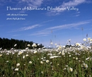
Daisys along Hwy 200 near Ovando

Beargrass as we start up Elk Creek Road in the Garnet Range

Coloma Cemetary

Coloma Miner's Cabin with an amazing view toward the Swan Range

Coloma Beargrass

Looking toward Pyramid Peak in the Swans

Coloma Miners Cabin

Mining Carts in Garnet

Garnet Ghostown

We left Garnet and rode past Reynolds City then on out Mulkey Gulch after some meandering on unmarked roads. No we weren't lost - we had plenty of gas! And the GPS knew exactly where we were - there just weren't any roads or trails on the display!

We didn't get to meet Charlie!

Here's something you won't find on the Interstate! And besides probably half the people you see up here are lost, too! Courtesy is a good idea!

Ophir Creek Road from near Avon looking south.

Looking back at the Garnet Range from Ophir Creek Road near Avon.

Looking toward Stemple Pass from near the top of the divide on Ophir Creek Road.

My KLR on Ophir Creek Road.

Manuel's KLR on Ophir Creek Road.

Miner's cabin on Lost Horse Road

Ore Bucket near Stamping Mill on Lost Horse Road

Stamping Mill on Lost Horse Road

Donkey Engine pieces at Stamping Mill

Water Break near Granite Butte

View west from near Continental Divide Trail close to Granite Butte

Granite Butte Lookout

Continental Divide Flowers

Looking toward Lincoln from near Granite Butte. We had a great ride - about 215 miles - mostly gravel and back country roads. Perfect weather and you never meet unfriendly people in places like this! Good maps, a GPS, and a SPOT satellite tracker are a good idea on a ride like this.
 The first goal of the day was to ride across the Garnet Range - those mountains in the distance.
 Daisys along Hwy 200 near Ovando
 Beargrass as we start up Elk Creek Road in the Garnet Range
 Coloma Cemetary
 Coloma Miner's Cabin with an amazing view toward the Swan Range
 Coloma Beargrass
 Looking toward Pyramid Peak in the Swans
 Coloma Miners Cabin
 Mining Carts in Garnet
 Garnet Ghostown
 We left Garnet and rode past Reynolds City then on out Mulkey Gulch after some meandering on unmarked roads. No we weren't lost - we had plenty of gas! And the GPS knew exactly where we were - there just weren't any roads or trails on the display!
 We didn't get to meet Charlie!
 Here's something you won't find on the Interstate! And besides probably half the people you see up here are lost, too! Courtesy is a good idea!
 Ophir Creek Road from near Avon looking south.
 Looking back at the Garnet Range from Ophir Creek Road near Avon.
 Looking toward Stemple Pass from near the top of the divide on Ophir Creek Road.
 My KLR on Ophir Creek Road.
 Manuel's KLR on Ophir Creek Road.
 The junction of Ophir Creek Road and Lost Horse Road.
 The GPS batteries died so we have to do it the old fashion way!
 Miner's cabin on Lost Horse Road
 Ore Bucket near Stamping Mill on Lost Horse Road
 Stamping Mill on Lost Horse Road
 Donkey Engine pieces at Stamping Mill
 Water Break near Granite Butte
 View west from near Continental Divide Trail close to Granite Butte
 Granite Butte Lookout
 Continental Divide Flowers
 Looking toward Lincoln from near Granite Butte. We had a great ride - about 215 miles - mostly gravel and back country roads. Perfect weather and you never meet unfriendly people in places like this! Good maps, a GPS, and a SPOT satellite tracker are a good idea on a ride like this.


No comments:
Post a Comment